Chile
WEEK 1
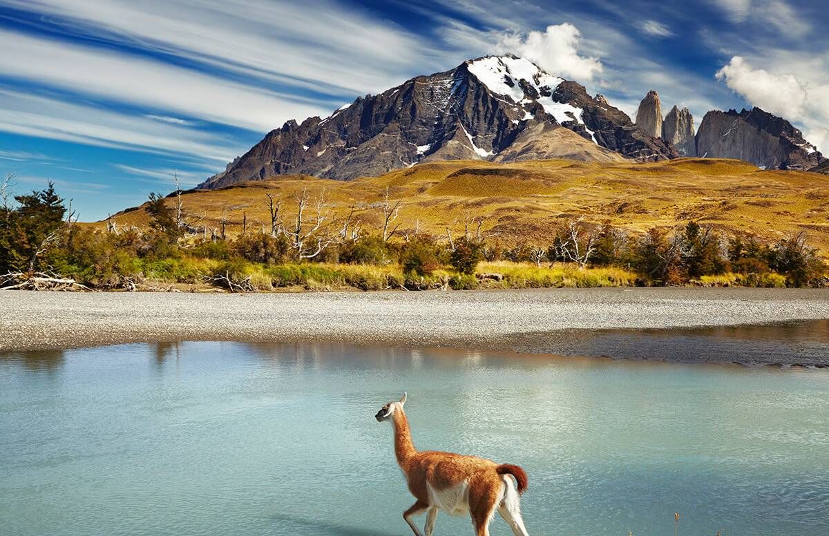
Credit : Sharon McDonnell, Travel Blogger
“3 Ways to See Chile.” Next Avenue, 10 Jan. 2018, https://www.nextavenue.org/3-ways-to-see-chile/.
This is a picture of a place in Chile
captivating.
This is a map of Chile, Santiago, being its capital.

“Chile Map. | Chile, How to Speak Spanish, South American Countries.” Pinterest, https://www.pinterest.com/pin/505529126894508421/. Accessed 25 Aug. 2023.
As Britannica helps me to explain, Chile reigns along the boarder of South America. Since Chile is a long and skinner country, its length is 2,653 miles and its maximum width is only about 217 miles. Since the country's length is fairly long, there are many climates ranging from tropical deserts to a subantarctic tip, this country experiences many types of natural events. From extreme summer droughts, earthquakes, winter storms, and tsunamis, the people of this country have experienced many fierce occasions. The people of this country are lively, they have a National Dance named the "La Cueca", it shows love and the flirtation between a hen and rooster.
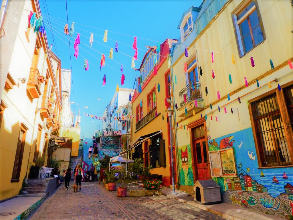
Credit : Josh Shepard, Travel Blogger
Josh. “10 Amazing Places to Visit Near Santiago, Chile.” The Lost Passport, 23 Nov. 2019, https://www.thelostpassport.com/places-to-visit-near-santiago/.
This photo can show the beauty of much they love and cherish art.
Moving on...
Hazards, disasters and catastrophes are all different from each other in their own unique ways.
As Dr. Ana Garci'a helps me to explain, a hazard is as she states, A "natural process/event that is a potential threat to human life and property, No area is considered ‘hazard-free".". A disaster is as she states, "a hazardous event that occurs over a limited time span within a defined area". If either more than 10 people are killed or more than 100 people are affected, or if it is a declared state of an emergency, or lastly, the country has requested international assistance, it is considered a disaster. Finally, As Dr. Ana Garci'a helps me to explain, a catastrophe is as she states, "a massive disaster that requires significant expenditure of money and a long time (years) for recovery".
An example of a catastrophe that happened in Chile was in the year 1960, on May 22. It was called the Valdivia earthquake... at a whopping number of 9.5, it is the highest recorded earthquake record for Chile. This extreme earthquake caused a large tsunami that traveled across the Pacific, which in turn affected many other places including Japan and Hawaii. As National Geographic helps me to explain... "The Valdivia earthquake left two million people homeless, injured at least 3,000, and killed approximately 1,655. The economic damage totaled $550 million (more than $4.8 billion, adjusted for 2020 inflation)". The rupture zone affected 311- 612 miles worth of land.
Valdivia Earthquake Strikes Chile. https://education.nationalgeographic.org/resource/valdivia-earthquake-strikes-chile. Accessed 25 Aug. 2023.
WEEK 2
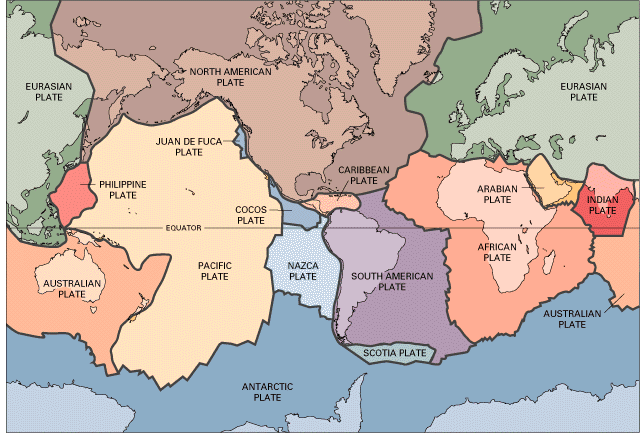
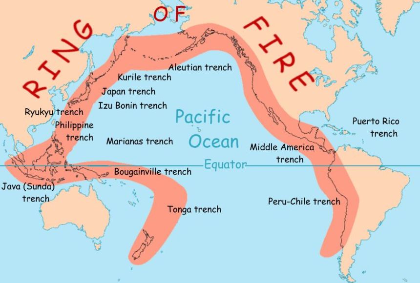
Plate Tectonics and the Ring of Fire. https://education.nationalgeographic.org/resource/plate-tectonics-ring-fire. Accessed 3 Sept. 2023.
As Brittanica helps me to explain, the Nazca Plate is 6,023,000 square miles in area. Britannica states, "it dives at a rate of 6–10 cm (2.3–3.9 inches) per year under the South American Plate along a subduction zone that extends more than 7,500 km (4,660 miles)". This is important because this movement is what helped cause some of the most dangerous earthquakes in Chile. In 2010, The Nazca plate helped a -8.8 temblor occur in Chile, this triggered a tsunami and killed more than 500 people.
The South American Plate and the Nazca Plate helped create the Andes mountains.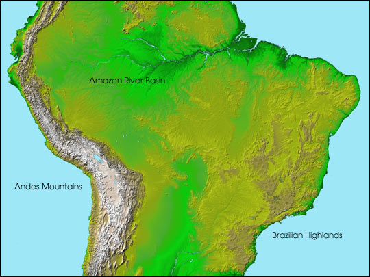
Topography of South America. 28 June 2003, https://earthobservatory.nasa.gov/images/3581/topography-of-south-america.
As the University of Rochester helps me to explain, they state, "the Nazca oceanic plate slips underneath the South American continental plate, causing the Earth's crust to shorten (by folding and faulting) and thicken".
Welcome to Geol9!
ReplyDelete